
The Abandoned, Old or Interesting Places in Pennsylvania Facebook page shared multiple photos of greater Glenside’s past this year.
Below are samples, along with their respective captions:
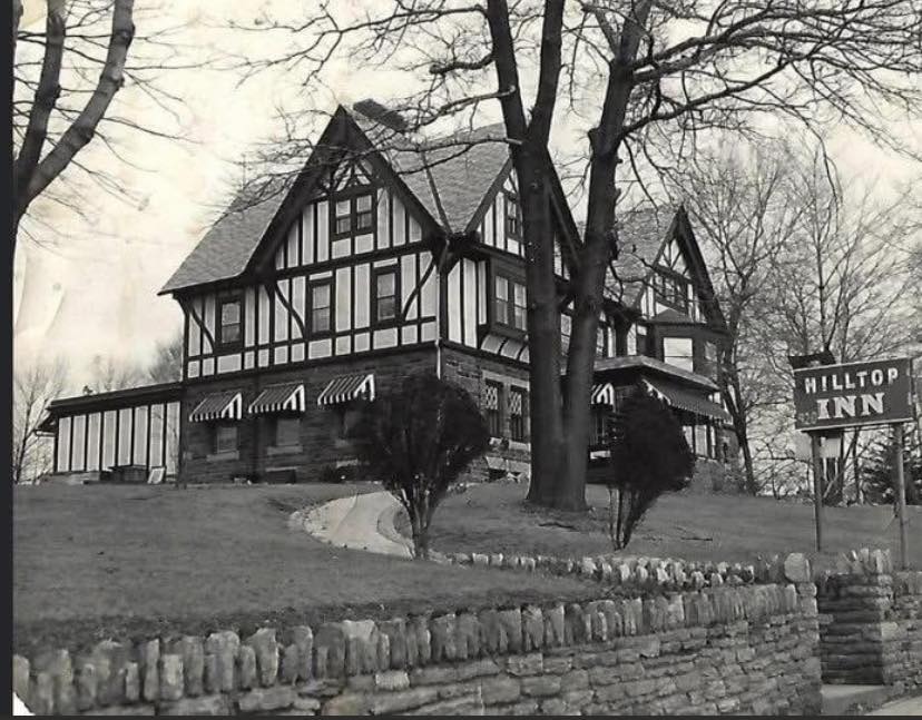
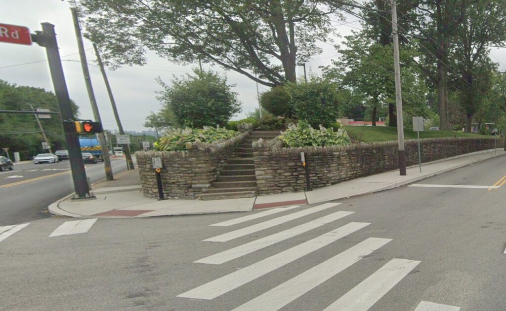
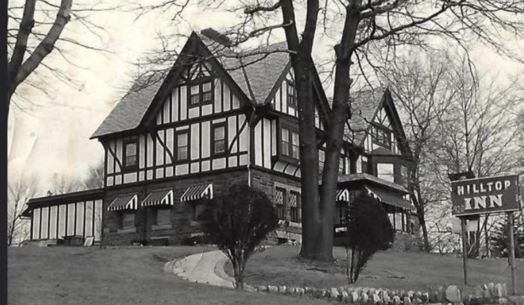
Hill Top Inn at Edge Hill and Easton Roads., Glenside Pa. After a fire in the mid 1960s, the location became Lum’s Restaurant and later Burger King.
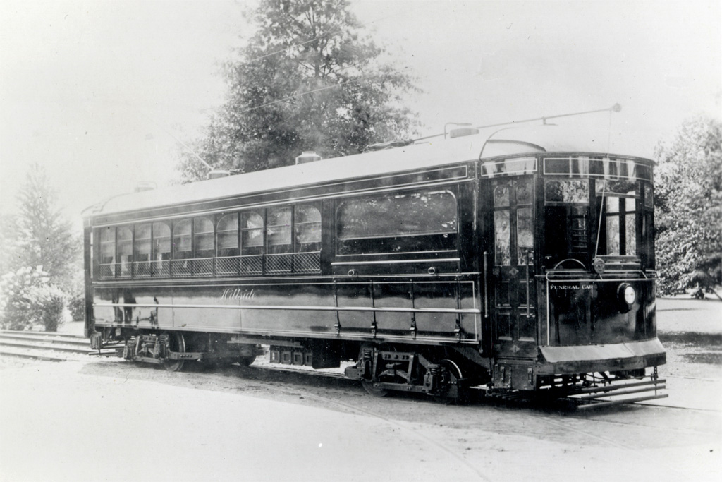
Philadelphia Rapid Transit Company funeral trolley, the “Hillside,” named for the cemetery in suburban Abington Township. Built in July 1912, scrapped in 1932.
Seats were provided for forty mourners and six pall bearers. The casket was placed in the space below the large window.
The location of this photo is near Willow Grove Park.
Harold E. Cox noted wryly that the provision of a hard wooden bench seat opposite the casket “presumably was to put the pall bearers in a proper somber state of mind.”
Built primarily to serve Hillside Cemetery, Dr. Cox notes “almost every cemetery in the city of Philadelphia used the car at one time or another.”
Harry Foesig collection
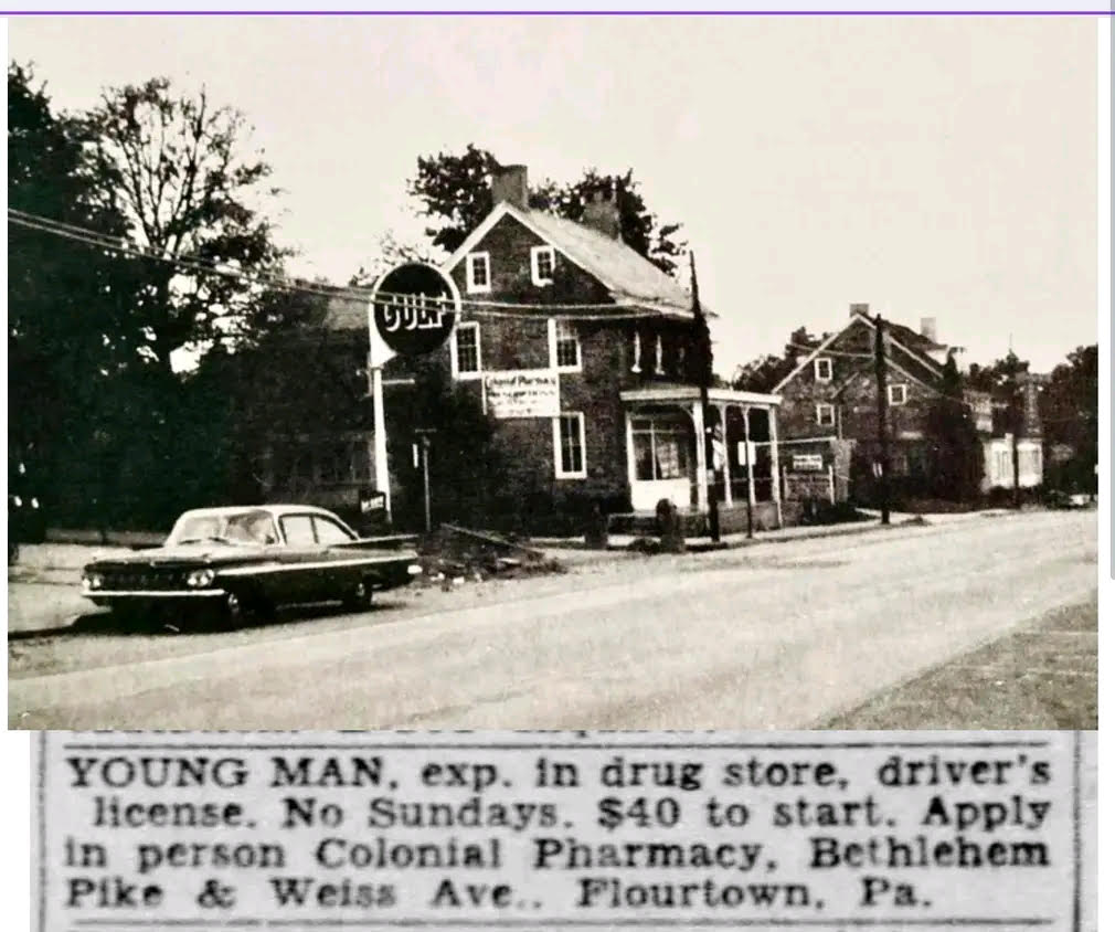
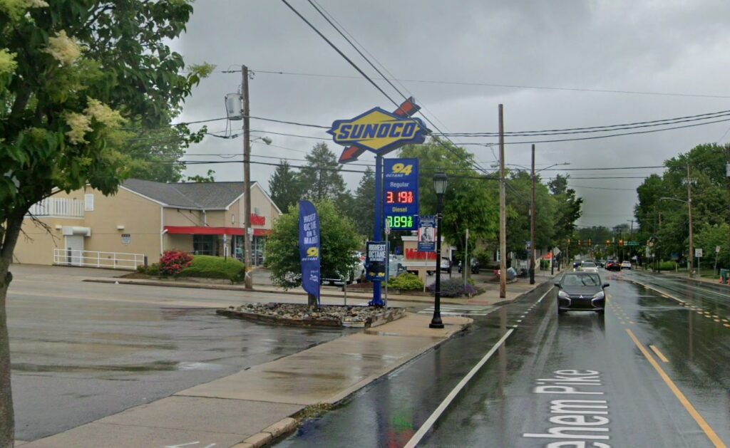
Colonial Pharmacy, Bethlehem Pike and Weiss Ave, Flourtown Pa. ca. 1950s. Today the gulf station is Sunoco and the pharmacy building in a Wawa. Difficult to see in the Google street view is the building past the Pharmacy which is still there and operates as Halligan’s Pub (previously the Block & Cleaver and Block & Candle restaurants – and probably more). Today the Gulf station is just past Halligan’s Pub. Also this is quite possibly the worst Wawa parking lot, with the exception of the one just north on Bethlehem Pike in Ft. Washington.
Photo from the Springfield Township Historical Society.
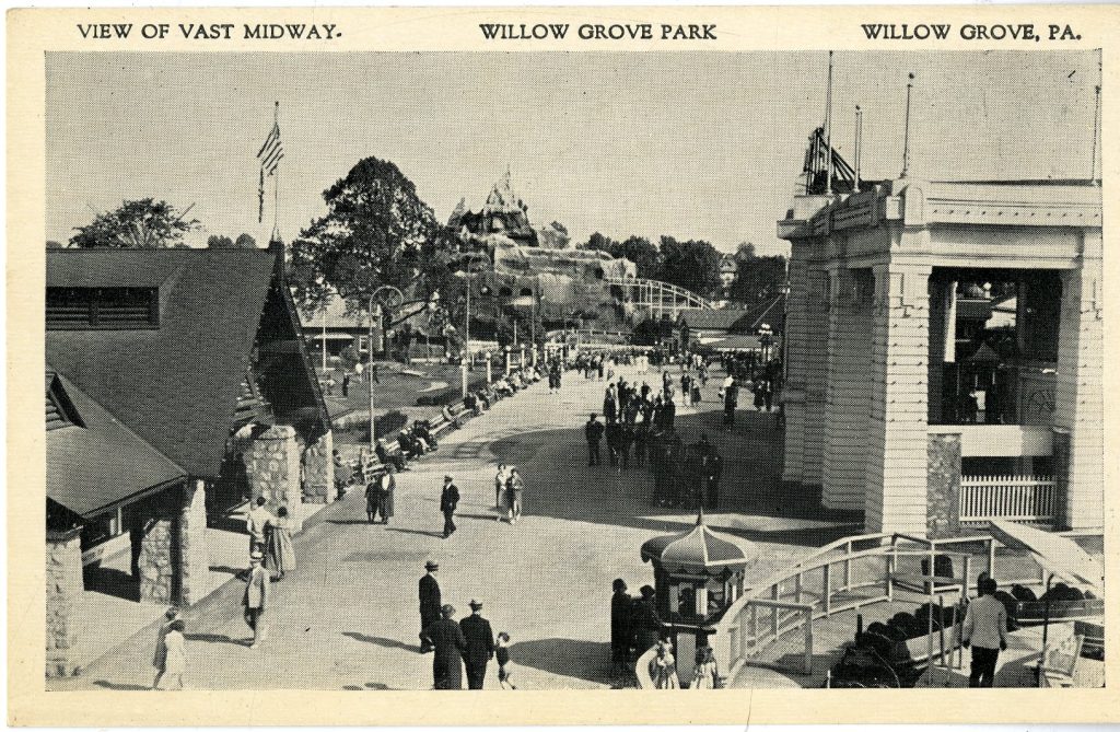
Midway, Willow Grove Park, ca. unknown.
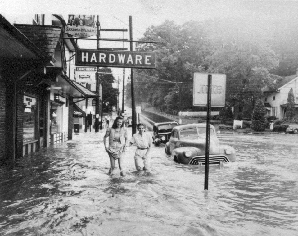
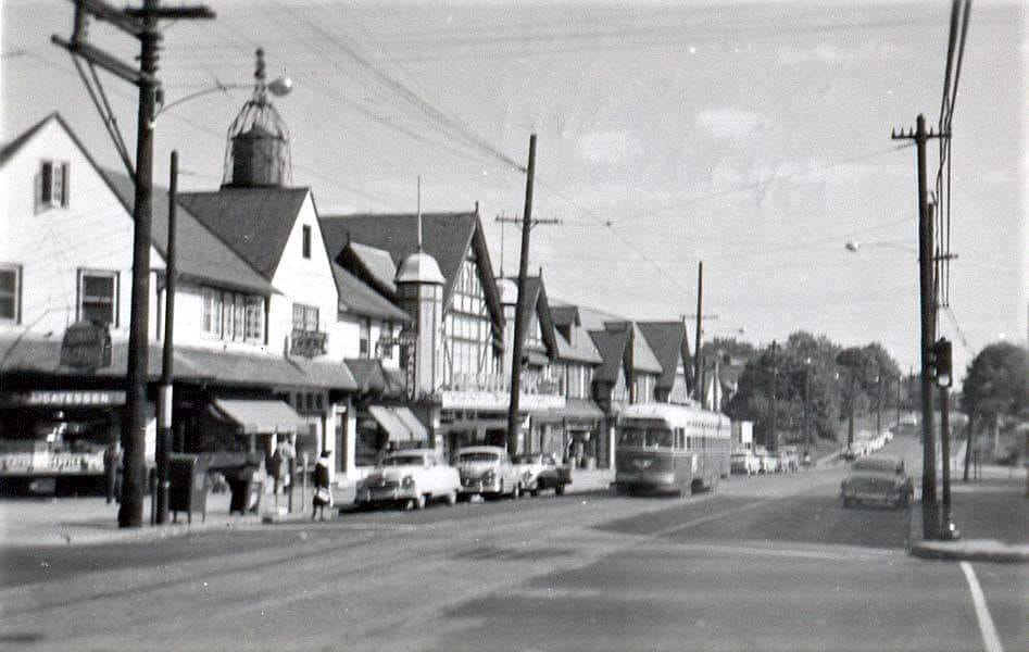
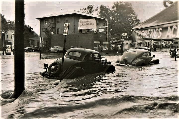
Keswick Avenue and Easton Road, ca. 1950s(?). I couldn’t find any info on a flood, but the first flood image looks to be Easton Road looking South. The 2nd flood image is from the corner store (see “Candy” in the first photo) looking NW. The building in the 2nd image is still there next to the 7-11 (https://maps.app.goo.gl/UMFrLd9otkcdgZcN8). The third image is looking SE along Keswick Ave. in front of the Keswick Theater. I had no idea there was a trolley line through there – does anyone know where it originated and where it went? Did this wind it’s way up Easton Road to the terminus at Willow Grove Park?
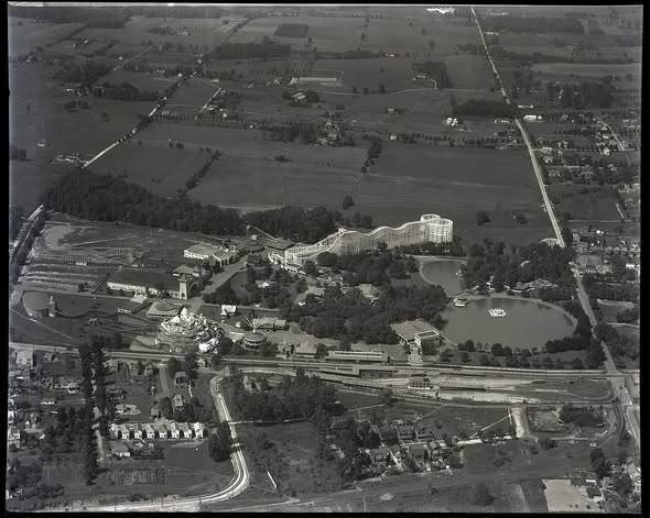
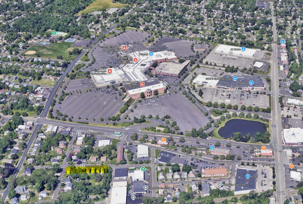
A 1926 aerial view of Willow Grove Park. From the previous images of Keswick Village, the Trolley (Route 6) began in Philadelphia and ended here at the park. The trolley ran through around 1954. The Google Maps screen shot approximates the view today. I highlighted the 8 clearly visible houses in the 1926 image on the modern image for reference.
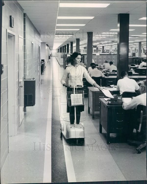
1965 Fort Washington, PA Honeywell Co Battery-Powered Scooter


Colonial Pharmacy, Bethlehem Pike and Weiss Ave, Flourtown Pa. ca. 1950s. Today the gulf station is Sunoco and the pharmacy building in a Wawa. Difficult to see in the Google street view is the building past the Pharmacy which is still there and operates as Halligan’s Pub (previously the Block & Cleaver and Block & Candle restaurants – and probably more). Today the Gulf station is just past Halligan’s Pub. Also this is quite possibly the worst Wawa parking lot, with the exception of the one just north on Bethlehem Pike in Ft. Washington.
Photo from the Springfield Township Historical Society.
For all the latest news, follow us on Facebook or sign up for Glenside Local’s “Daily Buzz” newsletter here.