
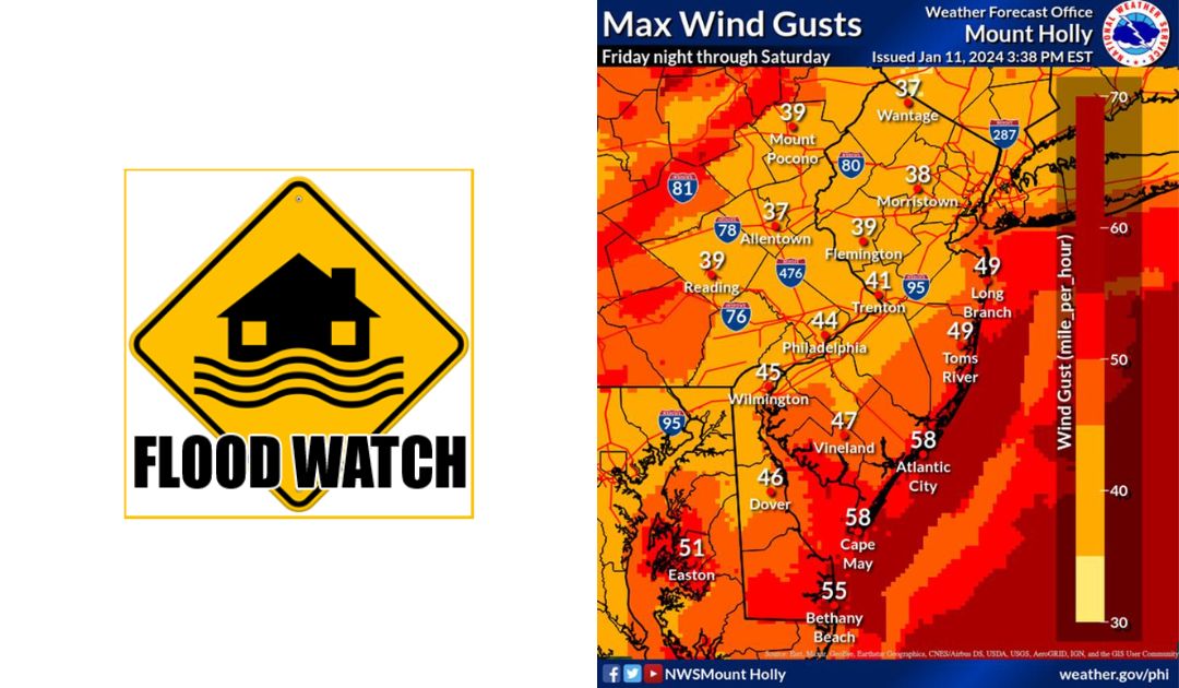
The National Weather Service is predicting roughly one inch of rain and strong wind gusts beginning Friday evening.
River flooding is expected, with the heaviest impacts between 11:00pm Friday and 4:00am Saturday. The National Weather Service has put Montgomery County under a Flood Watch and a Wind Advisory in effect tonight at 7:00pm until Saturday at 7:00am.
“While conditions are forecast to generally be less severe than the outgoing system, additional flooding, tree damage, power outages, and coastal flooding are possible once again,” the National Weather Service said.
The Montgomery County Office of Public Safety encourages residents to “Secure holiday decorations, outside furniture, and other lightweight items. Downed trees and wires are possible, leading to power outages. If you lose power, do not call 9-1-1 to report the outage. Contact your utility provider.”
A second system making its way across the country will bring temperatures into the 20s and teens early next week, forecasters said.
“The eastward expansion of the arctic air could make for a real mess where flood waters linger and then freeze. Similar problems could occur along some secondary roads where runoff continues in the wake of the big rain and wind storm from Friday to Saturday,” according to AccuWeather.
The latest forecast briefing is below:
For all the latest news, follow us on Facebook or sign up for Glenside Local’s “Daily Buzz” newsletter here.