

The National Weather Service is predicting a bit of snow and chillier temperatures in greater Glenside and surrounding areas beginning today.
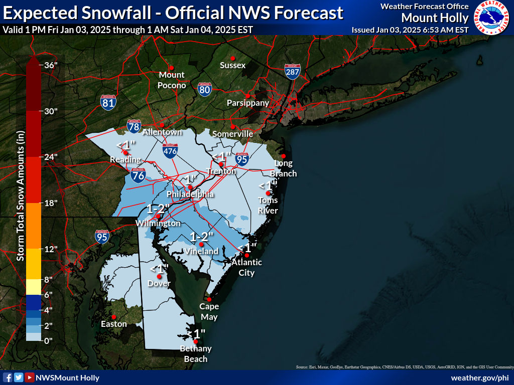
“Periods of light snow will develop this afternoon/evening. Snowfall and dropping temperatures could lead to slippery travel during the evening commute,” the agency said in a post. “For the system Sunday night/Monday, an official snowfall map will be released by this evening.”
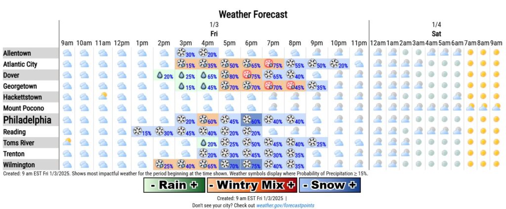
The NWS’ forecast for the week is below:
Today
A chance of snow, mainly after 3pm. Cloudy, with a high near 38. West wind around 10 mph, with gusts as high as 20 mph. Chance of precipitation is 40%. Total daytime snow accumulation of less than a half inch possible.
Tonight
Snow likely, mainly before 7pm. Cloudy during the early evening, then gradual clearing, with a low around 25. Northwest wind 5 to 15 mph. Chance of precipitation is 60%. New snow accumulation of less than a half inch possible.
Saturday
Sunny, with a high near 32. West wind 10 to 15 mph, with gusts as high as 30 mph.
Saturday Night
Mostly clear, with a low around 21. West wind around 10 mph, with gusts as high as 20 mph.
Sunday
Sunny, with a high near 33. West wind 10 to 15 mph.
Sunday Night
Snow likely, mainly after 1am. Mostly cloudy, with a low around 23. Chance of precipitation is 70%.
Monday
Snow. High near 29. Chance of precipitation is 80%.
Monday Night
A chance of snow before 1am. Mostly cloudy, with a low around 20. Chance of precipitation is 40%.
Tuesday
Sunny, with a high near 29.
Tuesday Night
Mostly clear, with a low around 17.
Wednesday
Mostly sunny, with a high near 29.
Wednesday Night
Partly cloudy, with a low around 15.
Thursday
Mostly sunny, with a high near 27.
For all the latest news, follow us on Facebook or sign up for Glenside Local’s “Daily Buzz” newsletter here.