
Winter has arrived.
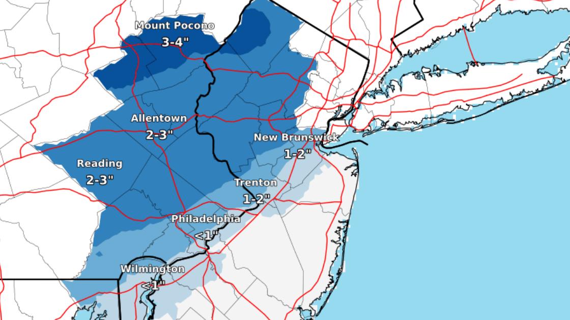
Snow, sleet, and ice are anticipated throughout the neighborhoods in Abington, Glenside, Roslyn, Wyncote, and surrounding communities. The map above details the anticipated amounts of snow in the area.
The National Weather Service has issued two warnings for much of the region, including Abington, Cheltenham, Springfield, and Upper Dublin Townships and Jenkintown and Rockledge Boroughs.
Tonight, the National Weather Service forecasts a mostly cloudy sky, with a low around 27 degrees. Winds are expected to be from the north at speeds of 3 to 6 miles per hour.
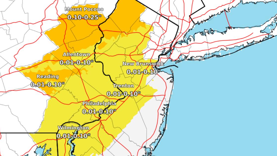
Expected levels of ice accumulations from 7:00 AM on November 15th through 1:00 PM on November 16th. The National Weather Service indicated that “confidence is moderate” for the forecasted levels of ice and snow. “A slower changeover to rain could result in higher snowfall totals [and] a more prolonged period of freezing rain could result in higher ice accumulations.”
Tomorrow, the National Weather Service forecasts “snow, freezing rain, and sleet before 4:00 PM, then snow between 4:00 PM and 5:00 PM, then rain and snow after 5:00 PM.”
The high temperature is expected to be near 34 degrees, according to the National Weather Service. Winds are expected to be from the northeast at 8 to 14 miles per hour. The “chance of precipitation is 100%. Little or no ice accumulation expected. New snow and sleet accumulation of 1 to 2 inches possible.”
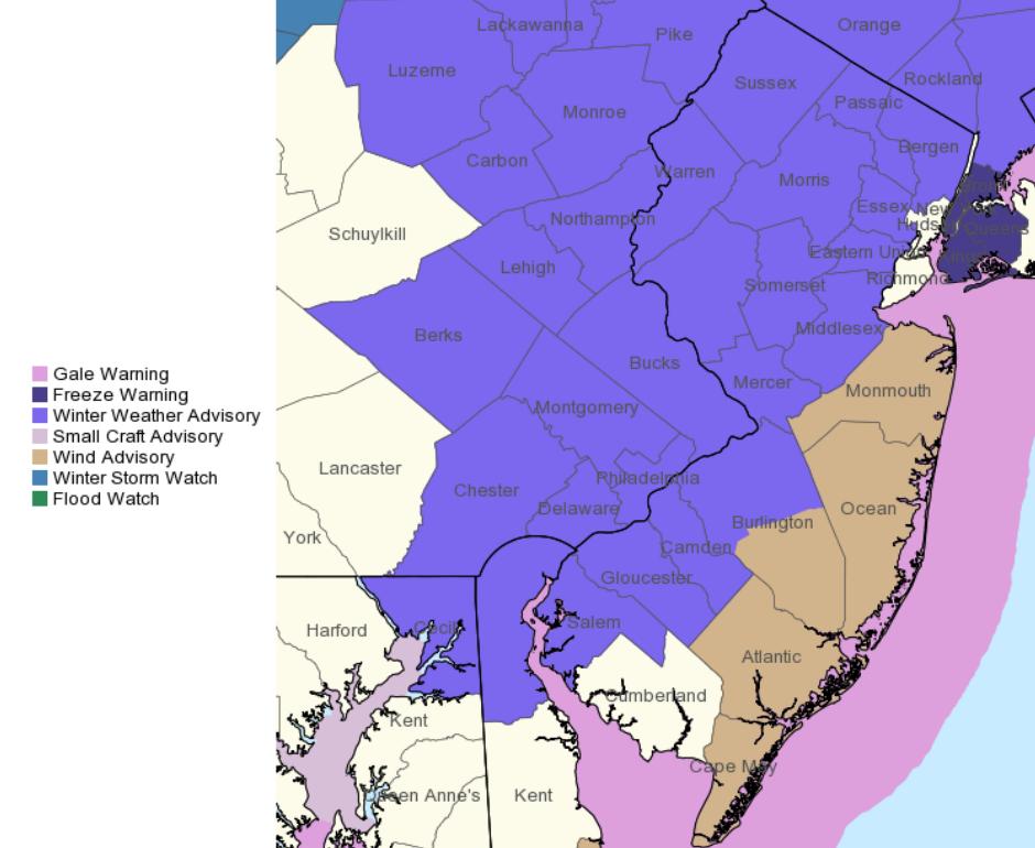
This map highlights a variety of warnings issued by the National Weather Service.
A Winter Weather Advisory has been issued by the National Weather Service through 3:00 PM on Thursday.
“Total snow accumulations up to one inch and ice accumulations of a light glaze expected,” according to the National Weather Service on late Wednesday afternoon.
The National Weather Service reports that “a Winter Weather Advisory means that periods of snow, sleet or freezing rain will cause travel difficulties. Expect slippery roads and limited visibilities, and use caution while driving.”
A Hazardous Weather Outlook has also been issued by the National Weather Service.
“As precipitation turns to rain by Thursday afternoon and evening, poor drainage and low lying flooding will be a possibility,” according to the National Weather Service.
Images are courtesy of the National Weather Service, 2018.