
PennDOT, the Pennsylvania Emergency Management Agency and the PA Turnpike Commission are advising drivers to avoid unnecessary travel during an expected storm across the state Wednesday into Thursday.
PennDOT and the PA Turnpike will implement various speed and vehicle restrictions throughout the storm, officials said.
“Beginning Wednesday morning, the storm will bring a band of snow across the state, followed by sleet and freezing rain. Temperatures below freezing will result in potentially icy conditions,” PennDOT said in a release. “PennDOT and PA Turnpike crews will actively pre-treat roadways where necessary ahead of the storm to help prevent ice from forming a bond with the pavement. However, salt does not resolve all risks, and drivers may encounter icy spots on the roadway. With freezing temperatures, roads that look wet may actually be icy, and extra caution is needed when approaching bridges and highway ramps where ice can form.”
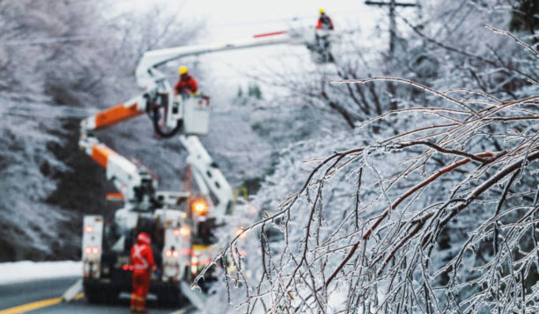
According to the National Weather Service, gusty winds could bring down trees and power lines and cause power outages.
The NWS’ latest briefing is below:
Their forecast for greater Glenside through Sunday:
Tonight
Increasing clouds, with a low around 23. North wind 5 to 10 mph, with gusts as high as 20 mph.
Wednesday
Cloudy, with a high near 34. North wind around 5 mph becoming calm in the afternoon.
Wednesday Night
A chance of snow, freezing rain, and sleet before 2am, then snow and sleet between 2am and 5am, then snow, freezing rain, and sleet after 5am. Low around 27. Calm wind becoming east around 5 mph after midnight. Chance of precipitation is 80%. Little or no ice accumulation expected. New snow and sleet accumulation of less than one inch possible.
Thursday
Rain, freezing rain and sleet, possibly mixed with snow, becoming all rain after 10am. High near 41. East wind 5 to 10 mph becoming southwest in the afternoon. Chance of precipitation is 100%. New ice accumulation of less than a 0.1 of an inch possible. New snow and sleet accumulation of less than a half inch possible.
Thursday Night
A slight chance of rain between 10pm and 1am. Mostly cloudy, with a low around 38. Southwest wind 5 to 10 mph, with gusts as high as 20 mph. Chance of precipitation is 20%.
Friday
Mostly sunny, with a high near 41.
Friday Night
Mostly cloudy, with a low around 24.
Saturday
A chance of snow after 1pm. Mostly cloudy, with a high near 37. Chance of precipitation is 50%.
Saturday Night
Rain, snow, and freezing rain, becoming all rain after 1am. Low around 30. Chance of precipitation is 90%.
Sunday
A chance of rain before 1pm. Mostly cloudy, with a high near 44. Chance of precipitation is 40%.
Sunday Night
Partly cloudy, with a low around 25.
From PennDOT’s announcement:
The following vehicle restrictions are planned to go into effect at 7:00 PM on Wednesday, February 5, in accordance with Tier 2 of the commonwealth’s weather event vehicle restriction plan.
- PA Turnpike I-70/76 from the New Stanton exit to the Carlisle exit.
The following vehicle restrictions are planned to go into effect at 7:00 PM on Wednesday, February 5, in accordance with Tier 4 of the commonwealth’s weather event vehicle restriction plan.
- I-70 from PA Turnpike I-76 to the Maryland border.
- I-79 from PA Turnpike I-76 to the end of I-79 North.
- I-81 from the Maryland border to I-80.
- I-83, entire length.
- I-99, entire length.
- I-283, entire length.
- I-376 from Toll 376 to I-80.
- Route 22 from Route 119 to I-99.
- Route 22/322 from I-81 to I-99.
The following vehicle restrictions are planned to go into effect at 10:00 PM on Wednesday, February 5, in accordance with Tier 4 of the commonwealth’s weather event vehicle restriction plan.
- I-80 from mile marker 4 to I-81.
- I-180, entire length.
The following vehicle restrictions are planned to go into effect at 12:01 AM on Thursday, February 6, in accordance with Tier 2 of the commonwealth’s weather event vehicle restriction plan.
- PA Turnpike Northeast Extension I-476 from the Lehigh Valley exit to the Clarks Summit exit.
The following vehicle restrictions are planned to go into effect at 12:01 AM on Thursday, February 6, in accordance with Tier 4 of the commonwealth’s weather event vehicle restriction plan.
- I-78, entire length.
- I-80 from I-81 to the New Jersey border.
- I-81 from I-80 to the New York border.
- I-84, full length.
- I-380, full length.
- Route 33, full length.
Under Tier 2 restrictions, the following vehicles are not permitted on affected roadways:
- Tractors without trailers.
- Tractors towing unloaded or lightly loaded enclosed trailers, open trailers or tank trailers.
- Tractors towing unloaded or lightly loaded tandem trailers.
- Tractors towing loaded tandem trailers without chains or Alternate Traction Devices (ATDs).
- Enclosed unloaded or lightly loaded cargo delivery trucks/box trucks that meet the definition of a CMV.
- Passenger vehicles (cars, SUV’s, pickup trucks, etc.) towing trailers.
- Recreational vehicles/motorhomes.
- School buses, commercial buses and motor coaches, regardless of the availability of trains or ATDs.
- Motorcycles.
On roadways with Tier 4 restrictions in place, no commercial vehicles are permitted. Additionally, all school buses, commercial buses, motor coaches, motorcycles, RVs/motorhomes and passenger vehicles (cars, SUVs, pickup trucks, etc.) towing trailers are not permitted on affected roadways while restrictions are in place.
For all the latest news, follow us on Facebook or sign up for Glenside Local’s “Daily Buzz” newsletter here.